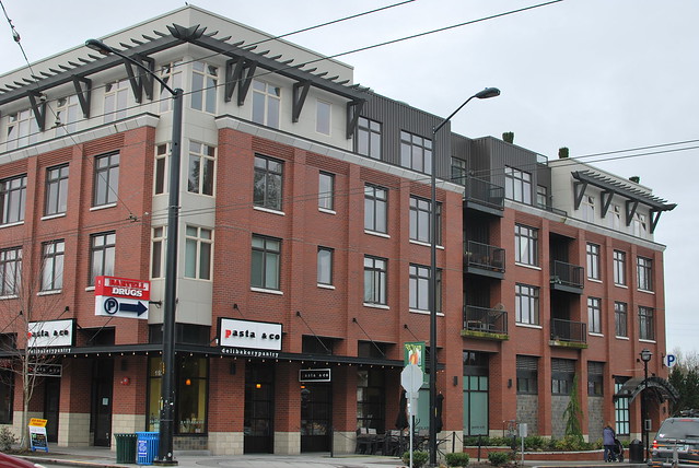
Showing posts with label transit-oriented. Show all posts

Wednesday, August 15, 2018

Proposed Housing Caps in Prince George’s New Zoning Code Threaten Mixed-Use Development

Photo by Plainurban on Flickr
As part of its effort to create a new, modern zoning ordinance to replace its bloated and antiquated half-century-old code, Prince George’s County is proposing a series of new mixed-use zones to encourage more development around transit. That’s good news—but if these new zones are going to thrive, they need to include more homes.

The current legislative draft proposes five mixed-use “Transit-Oriented/Activity Center” zones, all of which encourage walkable urbanism and transit-oriented development at varying scales. These zones “strongly encourage” mid-rise (generally three to seven stories tall) mixed-use buildings, with apartments or condos located above shops, businesses, or offices.

Unfortunately, the county is also proposing restrictive caps on the number of dwelling units allowed in mixed-use zones. If developers are not able to include enough housing in their projects to get a good return on their investment, it will be nearly impossible for them to justify the higher costs and greater hassle of constructing mixed-use buildings in the county.

The Region is Looking for More Homes, Not More Offices

As a result of prevailing market forces in the Washington region, Prince George’s is not likely to see many mixed-use buildings with multiple stories of office space above retail in the foreseeable future—particularly outside of its three “downtown” Metro station areas at Largo Town Center, New Carrollton, and Prince George’s Plaza.

The region’s office market is already significantly oversupplied, and its 14.2% office vacancy rate is among the highest in the nation. Businesses and organizations are increasingly requiring fewer square feet per worker than they did in the past. Open floor plans, use of electronic data over paper files, and the increasing popularity of telework are all shrinking offices.

Photo by Ron Cogswell on Flickr

For these reasons, the success of Prince George’s efforts to bring more mixed-use, transit-oriented development into the county will hinge on its ability to encourage developers to focus on building apartments and condominiums over lower-floor retail and office uses.

Fortunately, there is a significant unmet need in the region for multifamily housing near transit, particularly for millennials and seniors. In addition, a recent change in the International Building Code now allows developers to build five- or six-story wood-framed mixed-use buildings over a concrete podium of one or more stories, up to 85 feet high. Using wood framing on the upper levels of mid-rise buildings, rather than steel or concrete, helps to bring down construction costs. The concrete podiums can accommodate ground-floor shops, offices, or parking.

The Housing Caps in the New Code Could Scare Off Developers

Ironically, although the stated goal of the new zoning ordinance is to facilitate more mixed-use development, the housing caps proposed in the new code are actually more restrictive than the ones in the current code.

For example, in the Local Transit-Oriented (LTO) zone, where half of the county’s 15 Metro stations will be located, housing densities are capped at 40-60 dwelling units per acre. Essentially that means that in a modest mid-rise building on a one-acre lot, with four stories of apartments over one story of retail, the apartment or condo units could be in excess of 2,500 square feet each! That’s bigger than the median size of newly constructed single-family detached homes, which is 2,426 square feet.

Density caps are a bit larger within a quarter mile of the Regional Transit-Oriented (RTO) zones, where the larger downtown Metro stations will be. But even those densities—ranging from 80-120 dwelling units per acre—are not conducive for the type of high-rise development contemplated for those zones.

The Palette at Arts District Hyattsville. Image from Google Earth.

To give a real-world example, consider The Palette, located in Arts District Hyattsville. This mid-rise mixed-use building has four stories of apartments over a multi-story concrete podium containing parking. Its site plan states that there are 198 multifamily units of varying sizes in the building, which sits on a 1.85-acre lot. That creates a residential density of 107 dwelling units per acre.

Under the newly-proposed mixed use zones, The Palette could neither be built in Arts District Hyattsville nor near most of the county’s non-downtown Metro station areas, because the development would exceed the applicable density caps.

Remember, even on a one-acre lot, it would be possible to build 200 apartments at 750 square feet each in a mid-rise, four-over-one-story mixed-use building. That is larger than most one-bedroom apartments currently built in this region. Alternatively, a developer could build 125 units at a more generous 1,200 square feet each, which is roughly in between the nationwide median square footage for multifamily rental (1,088 SF) and multifamily for-sale (1,494 SF) units.

Check out this PowerPoint by architect Tim Smith to see other examples of attractive mid-rise mixed-use buildings at densities over 100 dwelling units per acre.

The County Can Easily Fix This

A recent county-commissioned survey of developers found that the county’s comparatively low property values, high development impact fees, and cumbersome development review processes combine to make Prince George’s one of the most expensive places to build in the region. Likewise, even with the recent changes in the International Building Code discussed earlier, mixed-use development is still much more expensive to accomplish than traditional suburban sprawl. Imposing these low housing caps will only make it harder and less economically feasible for developers to build in the county.

Prince George’s has been working for nearly four years to develop this new zoning ordinance. It will bring a lot of essential changes to the county, and there is no reason why the county cannot pass this legislation this fall. Before it does so, however, the county should amend these mixed-use zones to allow more housing units to be built in mixed-use developments.

One solution would be for the county to eliminate the caps altogether in the new mixed-use zones. Charlotte’s mixed-use TOD zones take this approach by imposing minimum, but not maximum, residential density requirements.

Another approach (one that I urged the County Council to adopt) would be to calculate both residential and non-residential density limits based on a more flexible floor area ratio (FAR) standard, which is what DC does. This allows developers to divvy up the available square footage into the number of homes and shops that makes the most market sense.

With the housing density caps proposed in the new zoning ordinance, it is reasonable to anticipate that many profit-minded developers may simply choose not to build mixed-use buildings in Prince George’s County. The County Council should fix this.

The County Council is still taking comments on the proposed zoning ordinance. If you would like to weigh in with your thoughts on this or other issues, you may submit your written comments by email or via regular mail addressed to the Clerk of Council, CAB - 2nd Floor, 14741 Governor Oden Bowie Dr, Upper Marlboro, MD 20772.


A version of this post appeared on Greater Greater Washington.

Tuesday, June 26, 2018

Residents Want to See Development at Deanwood Metro

Deanwood Metro Station Parking Lot. Image by Google Earth.

WMATA held a public hearing last week on its proposal to eliminate the commuter parking lot at the Deanwood Metro Station and offer the 1.6-acre site for potential joint development. The public’s message to Metro was clear: they want to see mixed-use development on that site, but it needs to be the kind of the development that responds to the needs and desires of the current community, first and foremost.

As I discussed earlier this month in my post on Greater Greater Washington, the transit agency attempted to market this site twice before, in the late 1990s, but received no interest from developers. Now, nearly 20 years later, Deanwood is getting a lot of developer interest—so much so that residents are complaining about unsolicited knocks at the doors of their homes from speculators looking to buy their property.

About 75 community members from the District and neighboring Prince George’s County packed the meeting room at the Deanwood Recreation Center to participate in Wednesday’s hearing. WMATA’s public hearing docket describes a possible joint development scenario that would contain 160 multifamily dwelling units and 10,000 square feet of retail space. However, the selected developer would ultimately be responsible for proposing the actual type and scale of development and then obtaining the necessary approvals from the District of Columbia government.

Community’s Vision: Grocery-Anchored Retail and Market-Rate Housing

Based on the residents’ comments at the hearing, WMATA’s initial vision for the redeveloped Deanwood Metro parking lot may be a tad too small. In particular, residents wanted to see a larger retail component than the 10,000 square feet that Metro envisioned. Nearly all of the speakers stated that they wanted to see a full-service grocery store as part of this development, along with other neighborhood-serving commercial uses such as a coffee shop, bank, and perhaps a medical office. Likewise, Ward 7 councilmember and former mayor Vincent Gray has been a fierce advocate for more and better quality grocery stores in the area. According to industry estimates, the median size for a grocery store in 2015 was 42,800 square feet.

Another longtime Deanwood senior citizen resident said it would be nice for the development to have a neighborhood bar/restaurant where younger professionals could gather for a nice meal or a happy hour. At the same time, residents did not want a retail mix that would encourage excessive noise generation in the neighborhood. Also, while most commenters supported the complete elimination of the Metro commuter lot, as Metro is proposing, many felt that DDOT would need to step up its enforcement of neighborhood parking restrictions, to keep street parking available primarily for the use of area’s existing residents and guests.

Most commenters stressed that the residential component of the Deanwood mixed-use development should focus on market-rate housing units, rather than income-restricted affordable housing units. They believe that Deanwood already has some of the most inexpensive market-rate housing in the Washington region and that Ward 7 has seen a number of new mixed-used, mixed-income developments constructed near the Minnesota Avenue and Benning Road Metro stations that primarily consisted of affordable housing units. Including more market-rate housing in this development would support the new retail development that the community wishes to see, commenters said.

My Proposed Development Scenario Largely Parallels the Community’s Vision

As a resident of the demographically similar inner-Beltway portion of Prince George’s County that borders Ward 7, I concur with many of the Deanwood residents’ views and expressed concerns. Accordingly, my written comments to WMATA propose a joint development scenario for the Deanwood Metro parking lot that largely incorporates those ideas.

Jenkins Row - A Grocery-Anchored Mixed-Use Development
Near Potomac Ave Metro. Image by Google Earth.

Like WMATA and the Ward 7 Economic Development Advisory Council, I believe the Deanwood Metro site can support “medium-density residential/low-density commercial” development. The District of Columbia’s Comprehensive Plan defines “medium-density residential” as “midrise (typically four- to seven-story) apartment development,” and “low-density commercial” as one- to two-story commercial uses.” WMATA’s proposed development scenario falls on the low-end of that scale; mine falls toward the upper end.

My proposal would use MU-6 zoning, a medium/high-density mixed-use zone that focuses on residential development but that also allows for up to 139,392 SF of non-residential development on the Deanwood Metro site. That is more than enough room for the 50,000 SF grocery store (with pharmacy, bakery, deli, ready-to-eat foods, beer/wine, and a coffee shop), 17,500 SF of additional retail uses, and 54,000 SF underground parking garage with 150 spaces that I propose.

With respect to the residential component, I echo the community’s belief that the development should focus on market-rate housing units. Nevertheless, I believe that it is appropriate and consistent with smart growth principles to include some affordable housing units near every transit station. Therefore, my proposal calls for 325 total multifamily units, with 20% of them as affordable units—i.e., 260 market-rate units (284,250 SF) and 65 affordable units (63,750 SF). Even with this number of affordable units, my proposal contains at least 100 more market-rate units than WMATA’s original development concept.

Let WMATA Know What You Think Before July 2

WMATA is accepting public comments on its Deanwood Metro joint development proposal until 9:00 am Monday, July 2, 2018. It is important that the agency hear your views.

You can submit public comments online—either in a text box or there is an option to upload a PDF file—or via mail to the Office of the Secretary, WMATA, 600 5th St NW, Washington, DC 20001. Remember to include the docket number (R18-01) in your correspondence.

Friday, October 6, 2017

When Will Prince George’s Pull the Plug on Dead Development Projects?

If a development project was approved for construction prior to the Great Recession, but it still hasn’t been able to get off of the ground yet, isn’t it time to acknowledge that the project is just…dead? Well, yes, obviously! So why does the Prince George’s County Council have so much trouble letting go of these projects?

Again this year, as it has since 2009, the council has introduced legislation that would prevent approved-but-unbuilt development projects from expiring until at least December 31, 2018. Ordinarily, under county law, most new subdivision plan approvals are valid for only three years, and most site plan approvals are valid for only two years.

Most of the county’s backlog of deadwood development projects consists of large single-family detached residential subdivisions located outside of the Beltway and far away from transit. These are exactly the types of suburban sprawl projects that the county’s own planners have concluded are harmful.

According to planners, this glut of existing and planned low-density residential development makes it harder for the county to develop at the appropriate densities around its 15 Metro stations. That, in turn, puts the county at a competitive disadvantage with both millennial and older homebuyers who are looking for walkable urban development close to transit and with nearby amenities.

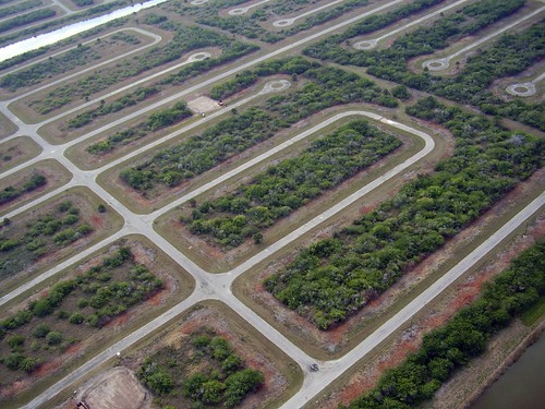
Additionally, studies show transit-oriented development (TOD) is a more fiscally sustainable form of development. Thus, the county council would do well to encourage new TOD projects around Metro, rather than clinging to far-flung sprawl projects in places that look like this:

Photo by Payton Chung
Moreover, there is no longer any market need for the county to keep extending the expiration dates on these long-stalled projects. The Great Recession has been over for quite some time now, and housing prices continue to rise in Prince George’s County. Indeed, County Executive Rushern Baker recently celebrated the county’s 61 percent increase in property values since 2010.

Lest you think that there’s no harm in extending the approvals on these dead projects, think again. Keeping old development projects in the pipeline significantly distorts the county’s true development landscape. That’s because the county still has to act as if all of the approved and unexpired development will in fact get built.

This means the county needs to plan and budget for more roads, water and sewer lines, schools, fire stations, and other public facilities to accommodate planned growth that has little possibility of ever happening. It also means new developers might be required to contribute to that new infrastructure, when it may not even be necessary for their particular projects. That puts an unnecessary burden and expense on new and otherwise viable projects, which ultimately discourages quality developers from building in the county.

The council will hold a public hearing on the latest extension bills, CB-97-2017 and CB-98-2017, on Tuesday, November 7, at 10:30 am. Please show up to testify and also contact the councilmembers to let them know your position on these bills.

Monday, October 2, 2017

Is Bias Tainting Prince George's Amazon HQ2 Bid?

Prince George’s County Executive Rushern Baker recently identified three Metrorail station areas as potential locations for Amazon’s new “HQ2” headquarters complex. All of them are in the northern part of the county, even though 10 of the county’s 15 Metro stations are located in the less affluent and more heavily African American portions of the county, south of U.S. Route 50.

One such downcounty site—the Morgan Boulevard Metro station area in central Prince George’s—seems to meet more of Amazon’s requirements. Yet, it didn’t make the county executive’s list. Could implicit bias and structural racism be clouding county officials’ judgment in these types of economic development and land use decisions?

Baker proposed the College Park, Greenbelt, and New Carrollton Metro station areas as potential HQ2 locations. David Iannucci, Baker’s assistant deputy administrator for economic development, stated that these three north county sites “offer[ed] Prince George’s County its best chance to compete for Amazon’s headquarters” based on the factors set out in Amazon’s RFP. In particular, Iannucci touted the locations’ proximity to the University of Maryland campus and the presence of interested developers.

What Does Amazon Want?

As relevant here, Amazon says it needs (1) a huge amount of space (2) with direct access to mass transit and (3) not more than 2 miles from a major highway (4) that is immediately available for development beginning in 2019. The company envisions that its HQ2 site will have 50,000 employees and occupy 8 million square feet of space at full buildout. While the space need not be contiguous, Amazon specifies that recommended sites “should be in proximity to each other to foster a sense of place and be pedestrian-friendly.”

Although Amazon states that it “may consider” sites with existing buildings that could be retrofitted or expanded, it clearly provides that it “will prioritize certified or shovel-ready greenfield sites and infill opportunities with appropriate infrastructure and ability to meet the Project’s timeline and development demands.” The ideal greenfield site would have approximately 100 acres of developable space, according to the company.

Do the North County Sites Fit the Bill?

Do Baker’s three selected north county sites best match up to Amazon’s RFP? Let’s take a look.

College Park Metro Area. Image by Prince George's County.

The proposed College Park site, shown above, is an amalgamation of scattered parcels cobbled together to form approximately 128 acres. Most of the parcels already have buildings with active uses on them, which is clearly not the greenfield development scenario Amazon prefers. Additionally, portions of the site, such as the 25-acre Discovery District parcel in the northwest corner of the picture, are nearly a mile away from the Metro station by foot. That’s well outside the half-mile/ten-minute-walk station area. Finally, the site is more than three miles from the Beltway, which exceeds the maximum two-mile distance stated in Amazon’s RFP.

The Greenbelt Metro station area (not pictured), which the county had recently been marketing for the now-stalled new FBI headquarters project, has an approximately 80-acre surface parking lot that could potentially be available for immediate development. However, while the site is adjacent to the Capital Beltway, there is currently no convenient or direct access from there to the southbound inner loop of the Beltway. The Maryland State Highway Administration is nearing completion of the design phase for a reconstructed Beltway interchange, but it has not been funded or scheduled for construction and, therefore, won’t be ready by 2019.

New Carrollton Metro Area. Image by Prince George's County.

The proposed New Carrollton Station area, pictured above, promises Amazon more than 300 acres of developable space around the Metro/MARC/Amtrak/Bus station. The problem: pretty much none of that space is currently available—including an occupied residential condominium complex north of the station, an occupied office park south of the station, and adjacent WMATA and state-owned property on both sides of the station that is already promised to another developer. Additionally, because the space at New Carrollton is bisected by the Northeast Corridor rail lines, it would require construction of massive and expensive roadway infrastructure over the rail lines to make the area pedestrian friendly. None of those roads has been designed, engineered, or funded.

Thus, while each of these north county sites has great transit-oriented development (TOD) potential, none of them quite meets Amazon’s RFP requirements.

What About Morgan Boulevard?

Now let’s take a look at Morgan Boulevard. According to the county’s own estimate, this area (pictured below) has more than 225 acres of developable land within a 10-minute/half-mile walk of the Metro station.

Morgan Boulevard Metro Area. Interactive Map by Author.

More than half of that land is currently vacant, appropriately zoned for commercial development, and not otherwise committed to another massive project. Moreover, most of the vacant land closest to the station is owned by WMATA, which is actively supporting joint development opportunities with Amazon.

Additionally, unlike the north county station areas that the county recommended, Morgan Boulevard is connected to two Metrorail lines (Blue and Silver), providing direct transit access to downtown Washington, Reagan National Airport (and eventually Dulles International Airport), the Virginia Railway Express, and most of Northern Virginia. It is also within a mile of the Capital Beltway.

In other words, Morgan Boulevard appears to meet all of Amazon’s needs—and certainly does so to more of a degree than the three north county sites.

Is Bias to Blame for the Downcounty Snub?

So why did County Executive Baker not propose Morgan Boulevard for Amazon’s HQ2 site? When first asked, Iannucci simply asserted that the station area “did not rise to the level of” the northern county sites and “did not address enough of the RFP requirements” that Amazon put forth. Those excuses quickly fell apart when Iannucci was asked to identify the specific RFP deficiencies and to give concrete examples of how Morgan Boulevard supposedly did not match up to the north county locations.

Ultimately, Iannucci settled on the nebulous explanation that while the Morgan Boulevard station area met all of Amazon’s RFP requirements, the county nevertheless declined to recommend it as a potential HQ2 site because the Baker administration did not believe the area possessed a strong enough “potential to be transformed into the type of urban complex that Amazon apparently seeks.”

In other words, the Baker administration essentially refused to advocate for the centrally located Morgan Boulevard station area, even though it checked all of Amazon’s boxes, and instead chose to support three north county locations that plainly did not match up as well, if at all.

It’s true that Morgan Boulevard is located in a less affluent part of the county with a larger African American population. But do those socioeconomic and demographic factors trump any specific set of criteria articulated by Amazon and render Morgan Boulevard unworthy of consideration? Apparently so, in the minds of county officials.

When socioeconomic and demographic factors work to rob an otherwise qualified community of the opportunity to compete on fair and equal terms for a prized transit-oriented economic development opportunity, it’s often because the people making the decision are being negatively impacted by the dual scourges of implicit bias and structural racism.


It matters not that Prince George’s County is a majority African American county, or that County Executive Baker is an African American man. Internalized biases can be pervasive and toxic, even when the decision maker is a member of the affected minority or class group.

In order to combat implicit bias and structural racism, one first must be willing to acknowledge their existence, and then not be afraid to call them out if they are present. This is true for county administrators and citizens alike.

We must be willing to question and challenge the bases and motives underlying TOD site selections like these that unfairly exclude two-thirds of the transit station areas in the county, even when many of those stations would objectively meet the applicable site selection criteria.

UPDATE (10/20/2017): According to a press release issued yesterday, County Executive Baker added a fourth north county site in his official Amazon submission. That site, Konterra Town Center East, is a shining example of the county's failed economic development strategy, which often prioritizes outer-Beltway sprawl development over bringing transit-oriented development to the county's 15 Metro stations (again, two-thirds of which are in central and south county). Konterra indeed has the space Amazon may want, but it doesn't have direct access to a Metro station--a major requirement stated in Amazon's RFP for its HQ2 site. That county officials apparently value Konterra over a south county site like Morgan Boulevard, which meets all of Amazon's requirements, demonstrates how strong the north county bias is.

Wednesday, May 31, 2017

The Purple Line is Not What Prince George’s Needs

Image adapted by author; original from MTA
With 15 Metrorail stations and 8 MARC stations, Prince George’s County already has substantial rail transit infrastructure to facilitate tremendous economic growth, walkable urban development, and regional connectivity. Yet, virtually all of these station areas have remained underdeveloped and poorly utilized for decades.

The solutions to this predicament are multifold, but they certainly do not include introducing 11 new Purple Line light rail stations to the county mix. Instead, the county should invest in a more robust local bus system and in its exiting rail transit station areas.

The Purple Line is a 16-mile, 21-station light rail project proposed by the Maryland Transit Administration (MTA) to provide more direct east-west connections between Bethesda, Silver Spring, College Park, and New Carrollton. Ten of the stations would be in Montgomery County, and eleven would be in Prince George’s. The light rail system would connect to WMATA’s Red, Green, and Orange Metrorail lines, but would not be owned or operated by Washington’s regional transit authority.

Last August and again earlier this month, the U.S. District Court for the District of Columbia ruled that the Federal Transit Administration (FTA) could not move forward with awarding federal funds to the Purple Line until the agency conducts the requisite study to prepare a supplemental environmental impact statement (SEIS). Senior U.S. District Judge Richard J. Leon’s orders provide that the SEIS must address what impacts WMATA’s continuing ridership decline (including this year) and ongoing safety issues might have on the Purple Line.

Move Beyond the “Purple Haze”

Maryland Governor Larry Hogan, MTA, and many public officials and citizens in Prince George’s and Montgomery counties were outraged by the court’s rulings, and they fear that the Purple Line project may well be permanently derailed by the delays that an SEIS would cause.

Yesterday, Maryland appealed Judge Leon's decisions to the U.S. Court of Appeals for the D.C. Circuit. No one knows yet how quickly the appellate court will rule or whether the state's appeal will ultimately be successful.

If the Purple Line is indeed dead, perhaps that is a blessing in disguise for Prince George’s County. The Purple Line has always been more of a “purple haze”—an extravagance and distraction that the county does not need and that diverts essential public resources and attention away from the real solutions to the county’s transit and economic development inadequacies.

Image adapted by author; original by Michael Phams 
This is not to say that light rail is never an appropriate transit solution. Indeed, I have previously enthusiastically supported light rail expansion in my childhood hometown region. But adding a multibillion dollar light rail system in this particular area of northern Prince George’s County—which is already quite well served by WMATA heavy rail, MTA commuter rail, and regional and local buses—is an imprudent use of public resources.

(The nonprofit group Friends of the Capital Crescent Trail and others have offered many reasons why the Purple Line also may not be a good deal for Montgomery County, the bi-county region, and the State of Maryland as a whole; but this post is focused specifically on Prince George’s County.)

Fund a Better County Bus System

If Prince George’s officials are genuinely concerned with improving transit access in the county, the first thing they should do is improve the county’s anemic local bus system. Local and express buses have the capacity to serve even the most densely populated areas in the county that are not already within a half-mile of an existing Metrorail or MARC station. Indeed, buses are better equipped to reach the county’s current scattered population.

Currently, Prince George’s “TheBus” system has only 28 routes to serve its 487-square-mile area. It generates a meager 3.7 million trips per year, or 4 trips per capita, and does not operate in the late evenings or on weekends.

By contrast, in similarly-sized and -populated Montgomery County, the local “Ride On” bus system has 78 routes serving its 494-square-mile area, and generates an impressive 26 million trips per year (with 86,000 trips on a typical weekday), or 27 trips per capita. Even in tiny Arlington County, the “ART” local bus system has 17 routes covering its 26-square-mile area, and generates 2.8 million trips annually, or 13 trips per capita.


Prince George’s annual operating budget for bus transit services is approximately $25 million, as compared to Montgomery’s $125 million. Over the next six years, Prince George’s plans to spend only about $2.1 million in capital expenditures on bus transit, as compared to the $98.2 million that Montgomery plans to spend on buses and bus stops alone over that same period.

Meanwhile, Prince George’s has agreed to pay $120 million over the next six years toward the construction of the Purple Line, which will run only in a small sliver of the comparatively affluent northern part of the county.

Stated another way, over the next six years, Prince George’s County is planning to spend less than two percent of its planned capital investment in the Purple Line on countywide bus transit. This shocking inequity in transit expenditures should have true transit advocates picketing in droves at the County Administration Building in Upper Marlboro.

Image by Ben Schumin
It’s also worth noting that federal funding for buses and related infrastructure is available from FTA, at the same 80% match rate as light rail funding. Thus, if Prince George’s focused more of its attention on developing a robust local bus system, it would likely find a willing partner in the federal government.

Purple Line supporters may rightly argue, “Why can’t we just do both—have the Purple Line and improve our bus system?” Well…we could, in theory. But there hasn’t been much political will over the years to improve the county’s bus infrastructure, so it is hard to see how that resolve would magically appear after the county shells out $120 million for the Purple Line. The better strategy would be to take care of the longstanding countywide need for more and better buses first and then evaluate whether the Purple Line still makes sense.

Manage Sprawl and Strategically Invest in Existing Station Areas

Similarly, with so many underdeveloped rail transit stations around the county (including in the Purple Line corridor), it strains credulity for officials to suggest that the county needs light rail in order to spur economic development. In fact, according to the county itself, the opposite is true: the Purple Line could actually harm Prince George’s economic growth prospects.

The county’s current comprehensive plan, Plan Prince George’s 2035, discusses the somewhat enviable dilemma the county currently faces by having too many mixed use activity “centers,” most of which are located near existing Metrorail stations. The plan contends that having too many centers can actually “undermine economic growth” by spurring scattered development that will make it difficult “to achieve the density, intensity, and form necessary to support successful mixed-use, walkable communities and economic generators” at any one center.

Image by M-NCPPC
Already, without the Purple Line, the county has 28 designated centers, 19 of which are located at existing Metrorail and MARC stations. The county predicts that it will not have enough projected growth over the next 20 years to develop all of those stations. So logic dictates that building 11 new Purple Line stations is actually contrary to the county’s stated land use and growth policies.

One thing the county could and should do to improve its ability to grow its exiting transit station areas is to reduce its pipeline of dead sprawl projects and redirect some of that projected growth capacity to its existing Metro station areas. The county should also take more of a leading role (including financially) in redeveloping and revitalizing its neighborhood-scaled gateway station areas near the District of Columbia border.

Prince George’s future transit prosperity begins not with light rail, but with more local buses—running frequently, on time, seven days a week, and connecting citizens countywide to important county destinations and to the 23 Metrorail and MARC stations already constructed in the county. Likewise, Prince George’s economic development potential does not depend on new light rail transit stations, but rather lies in its existing Metrorail and MARC stations. So instead of brooding over the possible demise of the Purple Line, let's rise up and fight like hell for the county’s true transit and economic development priorities!

Monday, September 28, 2015

Prince George’s Should Allow Dead Sprawl Projects to Rest in Peace


Photo by Seamoor on Flickr
Ever since 2009, the Prince George’s County Council has continually extended the approval periods for unbuilt development projects, mostly consisting of single-family residential subdivisions located outside of the Beltway and away from transit.

Now, council members are considering legislation that would give these long-dead projects yet another two-year extension, through the end of 2017. It’s time for the council to give up the ghost on these projects.

Originally, the council granted these extensions to provide temporary relief to distressed developers in the wake of the Great Recession. But the recession is over. And while housing prices continue to rebound in Prince George’s, there is no current market demand for massive new single-family subdivisions outside of the Beltway. Indeed, buyers are still able to garner great deals on many spacious suburban homes that went into foreclosure during the housing bust.

These Zombie Projects Are Clogging the County's Pipeline

As I noted in 2013, it makes no sense for the council to extend the approval windows for these types of scattered sprawl projects. County planners have already concluded that such development is unhelpful for the county because it makes it “difficult to establish a critical mass of high-density development around any existing Metro station, as envisioned by the General Plan.”

More importantly, planners note that the county’s continuing lack of focus on high-quality mixed-use transit-oriented development puts it “at a continued disadvantage relative to its neighbors when it comes to attracting residents and employers who value the connectivity and amenities that other such communities provide.”

Despite those exhortations against sprawl development, the existing pipeline of approved-but-unbuilt projects outside of the Beltway led planners and the council to conclude in its current General Plan that the county actually has “too many” Metro stations, even before taking into account the future Purple Line light rail stations, and that developing all of them would “undermine economic growth.”

But if the council would instead just allow these old projects to die a natural death, the projected pipeline of residential development would dramatically decrease, and the county could readjust its long-term growth projections to include more transit-oriented development inside the Beltway. In particular, the county could decide to direct some much-needed attention toward its gateway neighborhoods and Metro stations near the D.C. border.

TAKE ACTION: The council’s Planning, Zoning, and Economic Development (PZED) Committee will consider the latest extension bills, CB-80-2015 and CB-81-2015, on Wednesday, September 30, at 1:30 pm in Room 2027 of the County Administration Building. You can use this link to address your comments to PZED Chair Andrea Harrison, with copies to committee director Jackie Brown and committee administrative aide Barbara Stone.

Sunday, April 26, 2015

Strolling Through “Downtown” New Carrollton


New Carrollton Station. Image by author.
The New Carrollton transit station in Prince George’s County—serving Metrorail, MARC, Amtrak, and a host of local, regional, and intercity buses—is the Washington region’s second-most significant multimodal transportation hub, behind Union Station in DC. Soon, Metro and county officials hope that the station will anchor the county’s first true “downtown.”

The Coalition for Smarter Growth (CSG) recently conducted an extensive walking tour of the station area to highlight the latest joint transit-oriented development (TOD) plans prepared by Urban Atlantic and Forest City Washington. WMATA and the State of Maryland selected these developers in 2010 to develop approximately 41 acres of surface parking area adjacent to and across from the station.

Image by WMATA

This project’s been a long time coming

New Carrollton’s longtime mayor, Andrew Hanko, explained how this project was the latest in a series of efforts over the past several decades to breathe life into the station area, which currently lies just outside of his city’s municipal limits. District 3 county councilwoman Dannielle Glaros echoed those sentiments and gave the group a brief history of the many comprehensive plans that the county has created for the area.

CSG policy director, Cheryl Cort, and the chief of countywide planning for the Prince George’s Planning Department, Derick Berlage, added that the county’s new General Plan fully supports this type of intensive development at New Carrollton, which is one of three “downtown” station areas slated to receive the bulk of the county’s economic development resources over the next 20 years. The others are Largo Town Center and Prince George’s Plaza.

(While I support the General Plan’s effort to direct up to half of the county’s future growth over the next 20 years to the three designated “downtowns” and five other “regional transit districts,” I continue to believe that the county can and should do more to develop and revitalize the close-in gateway Metro station areas near the DC line.)

The goal: build a viable central business district

At full build-out, these currently vacant parking lots are envisioned to have 2.7 million square feet of new TOD, including 1.3 million square feet of apartments (approximately 1,370 units), 1.1 million square feet of office space, 150,000 square feet of retail space, and 150,000 square feet of hotel space. It would look something like this:

Image by WMATA.

The first phase of development will be decidedly more modest, however: 260,000 square feet of apartments (approximately 260 units) and 13,000 square feet of retail. This is comparable to, but slightly smaller than, the Jenkins Row development across from the more neighborhood-scaled Potomac Avenue Metro Station in southeast Washington, DC, with about a quarter of the retail and slightly more residential.

Phase 1 of the project will go on the south side of the station, which has the bulk of the developable area. Just look at all this available space:

South side development areas. Image by author

Urban Atlantic’s Dan McCabe explained that starting on the station’s south side would also allow construction of the Purple Line’s eastern terminus station to proceed uninterrupted on the north side of the station, should the light rail project be approved by Governor Hogan.

If all goes as planned, groundbreaking on Phase 1 could occur as early as next year.

Stan Wall, director of WMATA’s Office of Real Estate and Station Area Planning, emphasized that future phases of development would need to be “market driven,” and that the joint development framework with Urban Atlantic and Forest City contemplates this. Essentially, WMATA would negotiate ground leases of up to 98 years for each discrete phase of the project, with a requirement that all development be transit-oriented and not interfere with Metro operations.

You can view more photos from the walking tour in this album.

* * *

Note: On Tuesday, April 28, 2015, from 5:00–8:00 p.m., the county Planning Department will host a community open house to discuss the transit district development plan for the county’s northern “downtown,” Prince George's Plaza. It will be at Prince George's Plaza Community Center, 6600 Adelphi Road, Hyattsville, MD 20782. Please attend if you can!

Tuesday, April 21, 2015

Smarter growth will expand Prince George's tax base


Capitol Heights Metro station is undeveloped. Image from WMATA.
Prince George's County Executive Rushern L. Baker III wants to raise real property tax rates by 16% to increase funding to public schools. The real way to boost Prince George's economy is to develop around its gateway Metro stations near the DC line.

Prince George's is home to the lowest median home values and highest property tax rates in the region, largely because of the low home values in its older, deteriorating communities that border the District of Columbia. Seven of the county's 15 Metrorail stations are in these gateway neighborhoods, but they all are devoid of any substantial transit-oriented development (TOD).

Improving existing home values will strengthen the tax base


Like many other suburbs, Prince George's County has historically been a bedroom community. The county's largest source of tax revenue comes from real property taxes, and 61% of taxable real estate is residential property.

It stands to reason, then, that even small increases in existing home values in the county would go a long way to raise revenues even without any major large-scale development.

Currently, median home values in the five Prince George's county subdivision areas bordering the District of Columbia fall 10-31% below the countywide median value of $269,800. If existing home values in these areas simply rose to that level, the county's taxable real estate base would increase by approximately $2.47 billion. That would add approximately $23.7 million annually in revenue to the county.

Of course, if the county got serious about developing the seven Metro stations located in these struggling communities (Capitol Heights, Addison Road, Cheverly, Southern Avenue, Naylor Road, Suitland, and West Hyattsville), real property revenues would soar much higher than the median.

Undeveloped transit station areas undermine economic growth


Shockingly, Prince George's current General Plan doesn't recommend any substantial growth around six of the seven Metro stations near the DC border over the next 20 years. (The Suitland station, next to the U.S. Census Bureau, is the exception.) Indeed, the county's planners believe there are currently "too many" Metro stations in the county and that developing all of them would "undermine economic growth."

More specifically, planners say that the six gateway Metro stations bordering DC, plus the four stand-alone MARC stations, plus all the planned stand-alone Purple Line stations should only account for 15% of the county's future growth in the next 20 years. That equates to fewer than 600 new housing units per transit station.

By contrast, the General Plan recommends putting 30-40% of the county's projected growth and development over the next 20 years—or up to 25,000 new housing units—far away from transit and mostly outside of the Beltway. This recommendation appears despite county-funded research that concludes that failing to focus on TOD puts the county "at a continued disadvantage relative to its neighbors."

Prince George's has continually squandered opportunities to focus its attention on revitalizing its neighborhoods inside the Beltway. Continuing to encourage scattered development away from transit has crippled the county financially, environmentally, and aesthetically.

Gateway communities can't wait 20 more years to redevelop


Old Central Ave at Southern Ave SE. Image by author.
The close-in Prince George's neighborhoods and Metro station areas near the DC line are likely the first thing the region's current and prospective residents think about when determining whether they would like to live and work in the county.

Until Prince George's County improves its gateway neighborhoods, it will be difficult for it to attract the region's best and brightest. The county can't wait another 20 years for that transformation to happen.

County executive Baker is rightly concerned with diversifying the county's revenue base, creating more jobs, and expanding the county's commercial tax base. To that end, he has advocated strongly for developing the end-of-line Metro stations at the Beltway's edge.

For example, he's called for the FBI to relocate its headquarters to Greenbelt Metro, for the state housing agency to relocate to New Carrollton Metro, and for a new regional medical center to come to Largo Town Center.

Likewise, the General Plan's strategy to direct 50% of future growth to the seven largest Metro stations (including the three mentioned above) plus National Harbor, and to create three "downtowns" at Largo, New Carrollton, and Prince George's Plaza, is sensible.

Still, the county's economic development strategy should also reach beyond downtown, and deeper inside the Beltway, to the neighborhood Metro stations near the District's edge. Most of the new development that the General Plan currently contemplates for outer-Beltway suburbia should instead be directed to these gateway areas.

Prince George's County cannot simply tax itself out of its last-place position in the region. Instead, its leaders need to become better stewards of the public's trust and the public's resources. The county's transit-rich gateway neighborhoods are economic engines ready and waiting to be fired up, but county leaders have to ignite the switch.

Prince George's must get serious about revitalizing its old streetcar suburbs. These vital neighborhoods can't be left to languish for another generation.


(This article is cross-posted on Greater Greater Washington.)

Monday, May 19, 2014

Prince George’s adopts “Sprawl Plan 2035” over community objections


Photo by thisisbossi on Flickr
It was supposed to be different this time. Prince George’s County’s new general plan was supposed to embrace a bold new vision for a more sustainable and transit-oriented growth strategy. Sadly, the county ultimately decided to cling to its previous failed approach of mouthing platitudes of support for walkable urban development around transit stations, while actively facilitating suburban sprawl outside of the Beltway and far away from transit.

County residents and smart growth advocates feared this eventuality when planners released the preliminary draft of Plan Prince George’s 2035, the updated countywide comprehensive plan for long-term growth and development, last fall. The draft placed too much emphasis on outer-Belway sprawl, ignored the revitalization needs of most inner-Beltway communities, and downplayed neighborhood Metro stations. At the same time, the draft plan supported massive greenfield development outside the Beltway—both at mixed-use “suburban centers” like Konterra and Westphalia, and also in scattered single-family residential subdivisions.

Each subsequent revision of the plan only made matters worse. When the Planning Board adopted its version of the plan in March, it added hundreds of acres to the exiting suburban Bowie Regional Center, which was already too disconnected from transit and well in excess of the half-mile radius that usually typifies a transit station area.

Likewise, when the County Council approved its version of the general plan earlier this month, it removed hundreds of additional acres of woodlands from the rural preservation area and placed them into the “established communities” area, making them eligible for further sprawl development. The council also added language specifically endorsing automobile-oriented suburban “town centers,” stating they “help[ed] fulfill countywide goals.”

Planners and council members repeatedly rebuffed calls for TOD fixes to plan

Ostensibly, the county's comprehensive planning process is designed to elicit meaningful public input regarding the substance of the planners’ drafts of the plan. In reality, though, the Planning Board and the County Council chose to ignore and sidestep the reforms urged by the public. They failed at nearly every turn to give fair consideration to ideas that would have helped the plan actually live up to its lofty policy pronouncements.

This pattern of public officials being dismissive of the public’s views unfortunately happens during most comprehensive planning processes in Prince George’s County—but it was supposed to be different this time.

When planners held their first town hall meeting about Plan Prince George’s last June, they appeared to be wedded to a strategy of picking 3 Metro station areas as “downtowns” and focusing most of their energies at those stations. I wondered aloud at the time whether their methodology for selecting high-performing stations was sound, whether they had a plan for how the remaining Metro, MARC, and Purple Line stations would develop over the next 20 years, and whether the planners’ continued encouragement of suburban greenfield development in “new town” centers made sense in light of what they were saying about the county’s need to focus on TOD.

Later that summer, I developed a more detailed policy paper (summarized here), setting forth various recommendations as to how planners could build upon their “3 downtowns” model by including policies and strategies that would help the county grow more smartly beyond its desired central business districts. I shared early drafts of the document with county planners and met with them to discuss it in detail.

The planners said they were surprised, but pleased, that a citizen had taken the time to develop such a comprehensive presentation. They indicated they would give serious consideration to the ideas expressed in the paper as they developed their initial draft of Plan Prince George’s. Yet, when the draft finally emerged, it did not reflect any of the policies or strategies suggested in the policy paper.

By the time the preliminary draft plan was before the Planning Board for review in March of this year, more than 100 citizens and public officials from across the county had signed a petition urging county officials to reconsider the land use priorities as expressed in the preliminary plan. Among the petition’s signatories were Maryland State Senator Joanne C. Benson, Capitol Heights Mayor Kito James, Seat Pleasant Mayor Eugene W. Grant, Forest Heights Mayor Jacqueline Goodall, and a host of civic leaders representing all 9 council districts. The Planning Board ignored these pleas and forwarded its sprawl-enhanced version of the plan to the County Council for approval on March 6.

On March 20, the petition group provided the council with a detailed set of proposed amendments to the Planning Board’s adopted version of the plan (summarized here). The Coalition for Smarter Growth also mounted an email campaign against many of the sprawl enhancements proposed by county officials.

Ultimately, the County Council turned a blind eye toward the petitioners and smart growth advocates, just as the Planning Board had. Led by council members Ingrid Turner (District 4) and Derrick Leon Davis (District 6), the council voted to approve "Sprawl Plan 2035" by a vote of 7-1. District 3 council member Eric Olson voted against the measure, and District 8 council member Obie Patterson was not present for the vote.

With that vote, the council once again sided with the well-financed developers who have fought hard to maintain the build-anywhere-you-want culture that has left Prince George's County with the least-developed and least-profitable Metro station areas in the region.

Future master plans and a better council could help undo the damage

In the end, Plan Prince George’s 2035 embodies the very same business-as-usual, undisciplined, sprawl-centered approach to future growth and development that planners cautioned the county against. While the plan says many of the right things about how and why the county should focus on developing its transit stations and reinvigorating its older communities, it ultimately allows and encourages uncontrolled sprawl growth away from transit centers and outside of the Beltway. As such, it does not provide much of an improvement over the 2002 general plan that it replaces.

Fortunately, the county does not have to wait another decade to right this wrong. Any future master plan or small-area sector plan can amend the general plan as it relates to that specific planning area. But to realize that opportunity, the county needs council members who are serious about focusing on smart growth.

Citizens need to realize what’s at stake during local elections, like the one we’re having on June 24, and choose forward-thinking leaders who can do more than just talk the talk when it comes to TOD.

Friday, March 21, 2014

Prince George’s Lawmakers Urged to Fix General Plan

Photo by MDGovpics on Flickr
(Updated March 29, 2014)

County planners have been working over the past year to revamp Prince George’s countywide comprehensive plan for future growth, known as Plan Prince George’s 2035 (“Plan 2035”). Since they released the preliminary plan draft last September, planners have received an earful—and a filing cabinet full—of public comments from concerned county citizens, who believe the plan is too encumbered by sprawl and gives scant attention to long-ignored, yet transit-rich, inner-Beltway communities. Now that the plan is before the County Council for review, calls to remedy several identified flaws in the plan are growing even louder.

Calls Increase to Fix Plan 2035 (#FixPlan2035)

Over the past several weeks, over 100 county residents have signed a petition urging county leaders to revise the plan to focus more on smart growth, transit-oriented development, and neighborhood revitalization inside the Beltway, and to turn away from the county’s traditional path of embracing massive suburban sprawl development far away from transit.

A number of state and local public officials have lent their support to the petition effort, including State Senator Joanne C. Benson, Seat Pleasant Mayor Eugene W. Grant, Capitol Heights Mayor Kito James, and Forest Heights Mayor Jacqueline Goodall. They were joined by several county civic leaders, including Douglas Edwards and Arthur Turner of the Coalition of Central Prince George’s County Civic Associations; William Cavitt of the Indian Head Highway Area Action Council; and Mike Hethmon of the Friends of Croom. Additionally, citizens from all nine of the county’s council districts have thrown their support behind the petition.

Despite the broad range of public support for reforms, the county Planning Board turned a blind eye toward the petition, failing to acknowledge its existence and not entertaining any discussion on its merits. On March 6, the board adopted and forwarded a revised version of Plan 2035 to the County Council for consideration and possible further amendment.

On March 20, as a follow-up to the petition effort, petition organizer Bradley Heard, a Capitol Heights lawyer and smart growth advocate, filed a 15-page set of proposed amendments with the County Council, urging lawmakers to revise the plan in line with the petitioners’ requests. Broadly speaking, the proposed amendments seek to do the following:
  • Revise the county’s growth policy map so that it syncs more closely with guidance provided by the Maryland Department of Planning and incorporates the targeted growth and revitalization areas previously recognized by the county and state as Sustainable Communities, Enterprise Zones, and Targeted Areas;
  • Develop a “Strategic Investment Policy” that details how the county will prioritize its infrastructure investments to catalyze development around regional and local transit centers (including assigning a high priority to Prince George’s Plaza Metro, New Carrollton Metro, and Largo Town Center Metro, where the county wants to establish “Downtowns”);
  • Simplify and clarify the descriptions of the different types of transit centers existing in the county (e.g., “Regional,” “Local,” and “Neighborhood”) and provide growth and density targets for each; and
  • Encourage mix-used transit-oriented development at all Metro, MARC, and future light rail stations, not just the 8 stations identified as “Regional” centers, and ensure that all stations are planned and zoned for densities that are supportive of rail transit.

The council will be reviewing Plan 2035 with county planners during informal, unrecorded "work sessions" that occur during the middle of the business day. While these sessions are technically open to the public, few citizens are actually aware of or able to attend and participate in these sessions. Petition organizers have urged the council to hold evening and weekend sessions to allow for greater public participation.

Under the current schedule, the council must either act to reject or accept the plan (with or without amendments) by May 6.

How would the proposed amendments improve Plan 2035?

Here’s a quick example of how the proposed amendments would address some of the more schizophrenic and unhelpful elements of the adopted version of Plan 2035. The plan's revised Land Use section has a subheading that states, “Too Many Centers Undermine Economic Growth.” Planners base that claim on the current low projections for future transit-oriented growth that the Metropolitan Washington Council of Governments (MWCOG) has predicted for Prince George’s County, based on the county's current non-transit-oriented growth trajectory. Plan 2035 acknowledges that there is “robust regional demand for transit-accessible development”; but since MWCOG thinks so little of it will come to the county, the plan concludes that we should only plan to build out 7 of our “regional” Metro stations (Greenbelt, College Park, PG Plaza, New Carrollton, Largo, Branch Ave, and Suitland), plus National Harbor.

The other 8 Metro stations…and the 6 other MARC stations…and the 6 other future Purple Line stations…and the 4 other future Southern Maryland Transit Corridor light rail stations that aren’t part of the “regional” category are relegated to the status of “local” centers and lumped in with massive non-transit-oriented future greenfield suburban sprawl projects like Westphalia and Konterra. Housing densities at the “local” Metro, MARC, and light rail stations are capped at levels that are not conducive to support rail transit (i.e., below 30 dwelling units per acre), and employers are discouraged from locating there. Meanwhile, housing densities at the greenfield sprawl sites are allowed to reach up to 40 dwelling units per acre, and those sites are projected to have hundreds of thousands of square feet of office space.

Our proposed amendments take a different approach. We view all of our transit stations as valuable assets, not as albatrosses that “undermine economic growth.” Therefore, the amendments increase the density targets at these stations to levels that are supportive of transit and encourage appropriately scaled mixed-use development (including jobs) to come to all transit stations. They also provide that a reasonable portion of the county's annual capital improvement expenditures will directed to these stations. While all these non-“regional” stations may not develop instantaneously, there’s no need to stifle development in those locations by capping density and not investing in them.

More importantly, given that our existing and planned transit stations and our other inner-Beltway growth areas and existing suburban sites like Bowie will provide virtually unlimited growth capacity for the county for the foreseeable future, the proposed amendments eliminate the sprawl category of “Town Centers” and do not promote additional greenfield development sites away from transit.

If these are the types of changes you support, please sign the petition and also separately call or email your council member to support the proposed amendments.

--
NOTE: If the above PDF Portfolio link to the proposed amendments will not open with your version of Adobe Reader, try these separate links to the cover letter and the attachment containing the proposed amendments.

Wednesday, February 26, 2014

Residents, City Leaders Urge Prince George's County to Reconsider Land Use Priorities


Image by M-NCPPC
(Updated March 4, 2014)

More than 100 Prince George’s County residents and municipal officials have signed onto a petition urging County Council members and planning commissioners to revise the current draft of the county’s General Plan. They are advocating for increased focus on developing neighborhood transit station areas and revitalizing existing older communities inside the Beltway, rather than on pursing new suburban sprawl projects.

The General Plan is the county’s long-range comprehensive roadmap that guides future growth and development. Maryland law requires counties to update their general plans at least once a decade, following the census. The Maryland-National Capital Park and Planning Commission (M-NCPPC) published the preliminary draft of “Plan Prince George’s 2035” last fall and held an initial joint public hearing with the County Council in November. Planners have spent the past several weeks reviewing and responding to oral and written public comments received through mid-December.

The preliminary plan draft recommends that 50% of the county’s future growth over the next 20 years should go to eight “Regional Transit Centers,” including National Harbor (which currently lacks a rapid transit connection) and seven of the county’s 15 Metrorail stations. But the plan also recommends that 30-40% of the county’s future growth should go to greenfield suburban developments outside of the Beltway and away from transit, such as the planned Westphalia Town Center near Upper Marlboro. Only 15% of future growth is recommended to go to the county’s remaining 20 Metro, MARC, and future Purple Line stations.

Many citizens and public officials have expressed concern that the preliminary plan unwisely prioritizes outer-Beltway sprawl over transit-oriented development (TOD) and revitalization. Lillie Thompson-Martin, mayor of the town of Fairmount Heights, charged that the plan was “starving the older established communities” by refusing them any meaningful revitalization assistance. She urged the county to designate her town and the surrounding unincorporated communities as “Neighborhood Revitalization Areas.”

Eugene W. Grant, mayor of the nearby city of Seat Pleasant, agrees. His petition comments urged the county to reevaluate how the plan treats Metrorail-accessible communities like his, saying they had been “overlooked” for “far too long” and that they have "tremendous potential." Grant further noted that refocusing on transit-oriented development around Metro stations would “stabilize our economy, create jobs, offer opportunities for local entrepreneurship … and so much more.”

Striking a similar tone, Capitol Heights mayor Kito James stated that inner-Beltway communities are the “future economic engine for Prince George's County,” and that reinvesting in the county's transit-rich core would elevate the county to “a new level of prosperity.” James noted that Montgomery County and Northern Virginia often outpace Prince George's because they have pursued an economic and land development strategy centered on "focused inner core reinvestment." 

Rev. Douglas Edwards, president of the Coalition of Central Prince George's County Community organizations, echoed the mayors' sentiments in his petition comments. "The inner-Beltway has been ignored far too long," Edwards said, citing specifically to the county's failure to develop the Addison Road and Morgan Boulevard Metro stations on the Blue Line. Those stations and the Capitol Heights station all have a number of redevelopment opportunity areas, including vacant parcels, within easy walking distance.

Even suburban county residents support a refocusing of the plan’s development priorities inside the Beltway, close to transit. Clinton resident Mary Forsht-Tucker lamented that creating additional automobile-oriented suburban town centers, as contemplated by the preliminary plan, would further clog already-overcrowded roads and make the quality of life “unbearable” for existing residents. “Doing away with the goal of having large developments built near mass transit makes a mockery of the decades of planning that preceded this Plan 2035,” she said.

Michael Hethmon, spokesperson for the Friends of Croom in southern Prince George’s County, argued that “rural tier preservation cannot occur without inside-[Beltway] TOD as the top goal of county planning.” Another civic leader, Indian Head Highway Area Action Council president William Cavitt, remarked that suburban sprawl was "self-defeating" and put the county in a "deeper financial hole."

The petition was created by Capitol Heights resident Bradley Heard, an attorney and civic activist who runs the smart growth-oriented blog Prince George’s Urbanist. It urges county leaders to revise the General Plan to direct 25-30% of future growth to local transit, neighborhood, or campus centers; to limit outer-Beltway suburban development to 10-15% of future growth; and to designate all areas designated as a Maryland Sustainable Community, Targeted Area, or Enterprise Zone as “Neighborhood Revitalization Areas.”

The preliminary draft of Plan Prince George’s 2035 is not yet final. M-NCPPC will consider the public comments received thus far and may make additional revisions to the preliminary plan before formally adopting it and sending it on to the County Council for further hearings. The County Council, which sits as the “District Council” when it considers land use matters, may make further revisions before approving the final General Plan sometime later this spring or summer.

To view the petition, click here. For more information on the preliminary plan draft, click here.